
About North Cyprus · Girne
Girne (Kyrenia): places to see
As of 24 October 2026: Girne (Kyrenia) is a port town on the north coast of Cyprus, below the Kyrenia (Beşparmak) Range. Sources describe a horseshoe-shaped old harbour with the castle on its east side, former carob warehouses along the quay, a few churches and a mosque in the old streets, and villages such as Bellapais, Lapta, Alsancak and Çatalköy within a short drive. Opening hours and fees are not listed here; check locally.
Checked 24 October 2026 against the sources named in the text and listed below. Positions of parties are attributed to them.

The old town and harbour
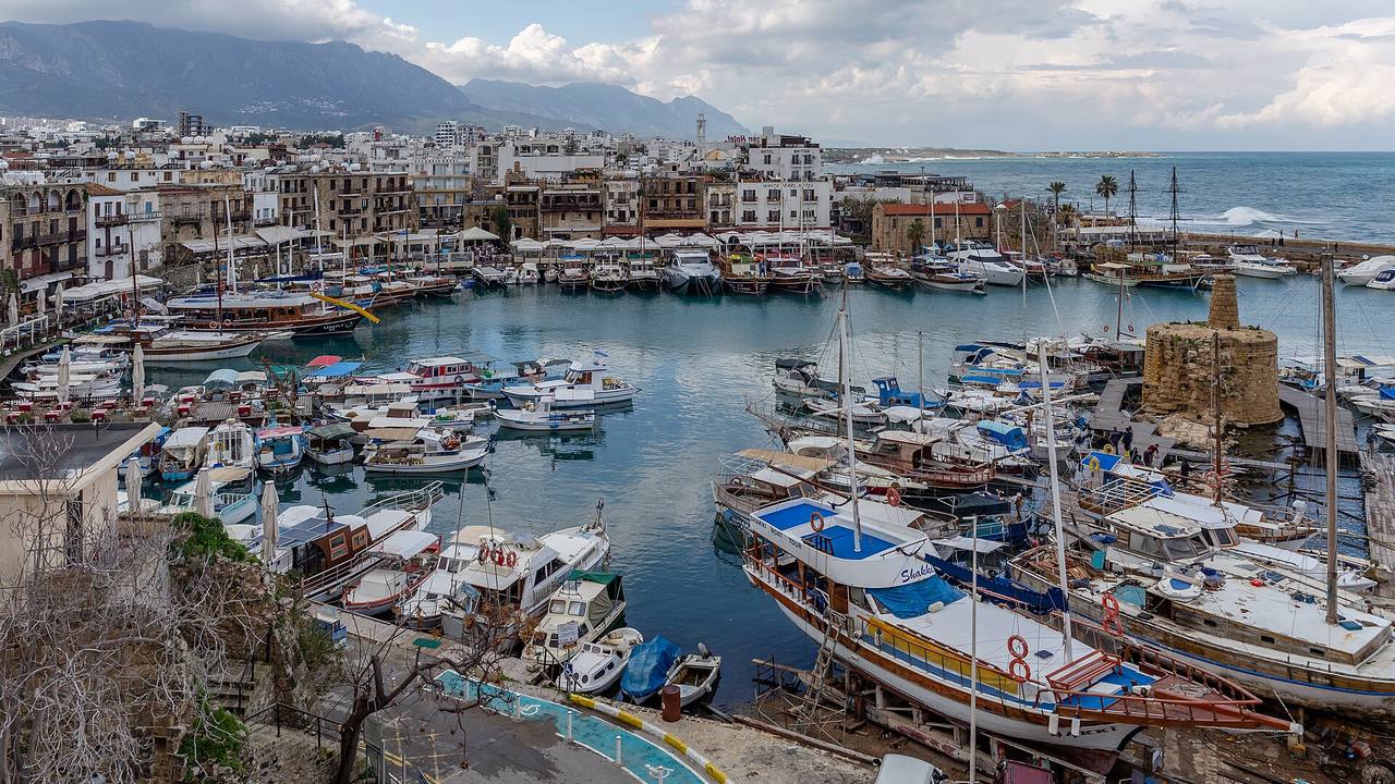
The TRNC Department of Antiquities and Museums describes Girne Castle as lying in the north-east of the town and dominating the harbour; Wikipedia likewise places it at the east end of the old harbour. Visit North Cyprus calls the harbour horseshoe-shaped and says its restaurants and cafés occupy former carob warehouses or Venetian dwellings. Where trading vessels once moored, it adds, pleasure craft and boats offering coastal cruises now lie. For the castle itself, see Castles of North Cyprus.
Visit North Cyprus states that the Kyrenia region harvested over a quarter of the island's carob pods, so the harbour became the centre of that trade and harbour-front buildings stored the crop before shipping; it says the international carob trade collapsed in the 1960s. The Severis Foundation holds a 1933 watercolour of the carob stores on the shore, painted by an amateur artist and described by the foundation as not precise in its topography. For dining along the quay, see nightlife and dining.
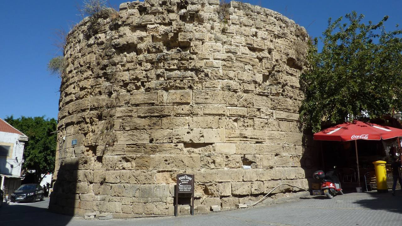
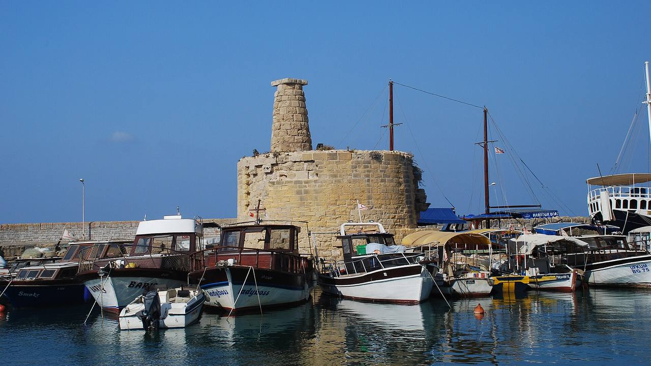
On the old defences, Wikipedia says the Lusignans built a wall and towers around the town and extended the fortifications to the harbour. Visit North Cyprus describes a round tower of about 1300 joined to others by a curtain wall, says the walls fell down gradually so that houses stood outside them by about 1600, and notes other tower remains. It also describes a Venetian chain tower that held a chain across the harbour entrance, with the old Customs House as the other tower. The same site lists boat trips from Kyrenia as gulet and sailing outings, usually mornings with lunch on board, plus short evening sails.
Michal Klajban · CC BY-SA 4.0 · Wikimedia Commons Harbour
Girne Eski Limanı (Kyrenia Old Harbour)
Visit North Cyprus describes a horseshoe-shaped harbour framed by the castle, where former carob warehouses or Venetian dwellings now house restaurants, cafés and shops, and where pleasure craft and cruise boats moor.
Source: visitncy.com
Chris06 · CC BY-SA 4.0 · Wikimedia Commons Old town
Yuvarlak Kule (Round Tower)
Visit North Cyprus dates this tower to around 1300, built with recycled Roman stones and once linked to other round towers by a curtain wall around the town; other remains survive near the harbour.
Source: visitncy.com
Josef Moser · CC BY-SA 4.0 · Wikimedia Commons Old town
Zincir Kulesi (Chain Tower)
Visit North Cyprus says the tower dates to the Venetian period and is often mistaken for a lighthouse; a chain once ran from it to the old Customs House to block hostile ships at the harbour entrance.
Source: visitncy.com
1 / 3

Museums, churches and the mosque near the harbour
The Department of Antiquities and Museums describes the Harup Ambarı ve Kıbrıs Evi Müzesi (Carob Warehouse and Cyprus House Museum) as standing on the harbour waterfront road and opened in 1974. It says the building reflects Cypriot houses from before the 17th century to recent times, with farm tools on the ground floor and handicrafts and household items upstairs. Our heritage and museums guide covers this museum and the Archangelos Mihail icon museum in more detail.
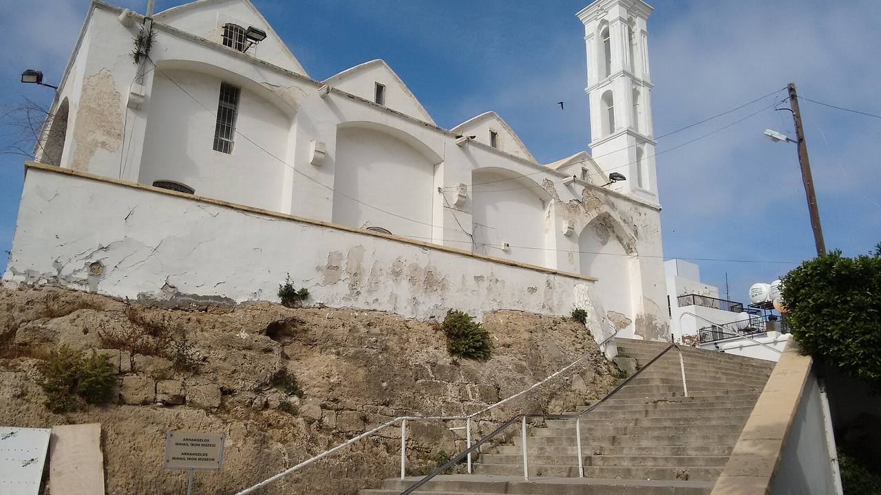
Visit North Cyprus describes the Archangelos Michael Church as a 19th-century Greek church with a white bell tower, now a museum of 18th- and 19th-century icons from Orthodox churches across North Cyprus. A traveller note on Wikivoyage says the church and museum were closed from 2018 for rebuilding, so check locally. The same site describes Chrysopolitissa as a small roofless ruin built as a Latin church in the 1500s with a Gothic north doorway, and St Andrew's as an Anglican church built in 1913, a few yards from the castle.
For the Ağa Cafer Paşa Mosque, Visit North Cyprus says it is named after the Ottoman governor who donated the land, was built in the 1580s although some sources say it was converted from a Lusignan warehouse, and has a fountain dated 1841; Wikipedia gives 1589 to 1590. Visit North Cyprus also counts about 70 known rock tombs in Kyrenia, noting that the Roman and Byzantine town lay east of the castle and that some tombs are visible in the cliff face in the town centre.
Héctor Ochoa 'Robot8A' · CC BY-SA 4.0 · Wikimedia Commons Church
Archangelos Mihail Kilisesi (Archangelos Michael Church)
Visit North Cyprus describes a 19th-century Greek church, now an icon museum with 18th- and 19th-century icons from Orthodox churches in North Cyprus; Wikivoyage reports a closure for rebuilding since 2018.
Source: visitncy.com
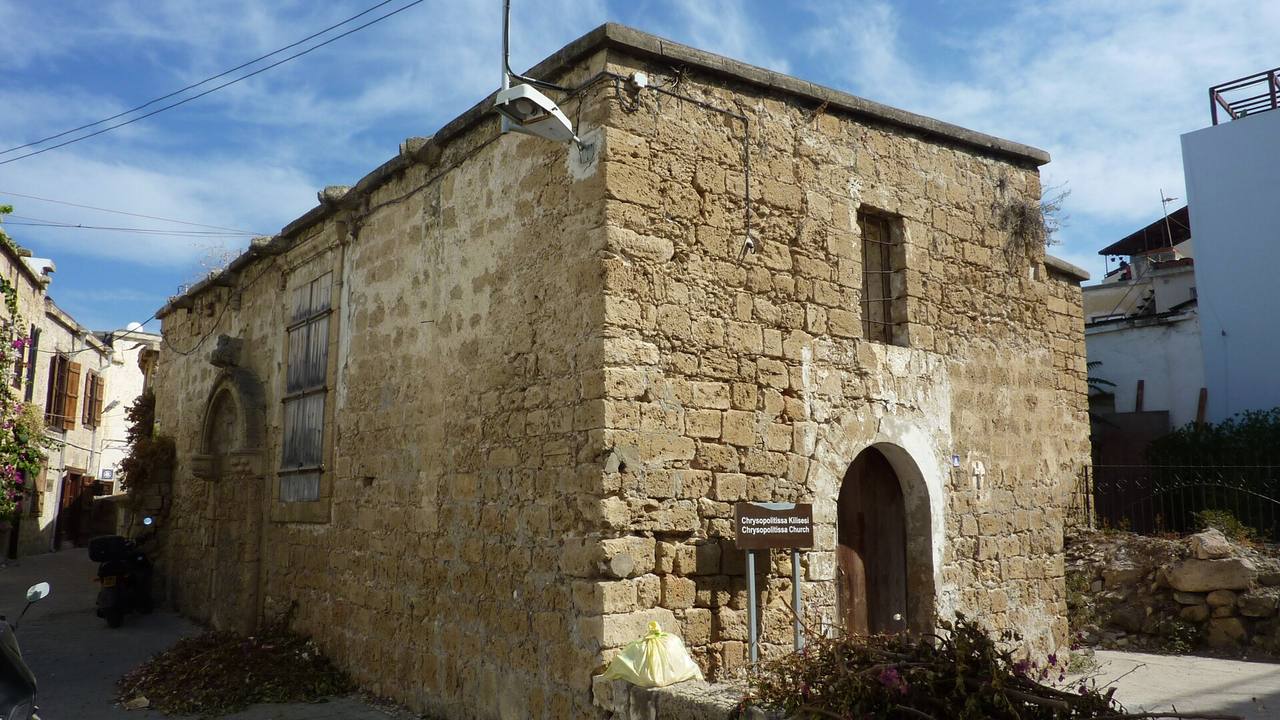
Chris06 · CC BY-SA 4.0 · Wikimedia Commons Church
Chrysopolitissa Kilisesi (Chrysopolitissa Church)
Visit North Cyprus describes a small roofless ruin in the back streets of the harbour, built as a Latin church in the 1500s, with a Gothic doorway on its north side.
Source: visitncy.com
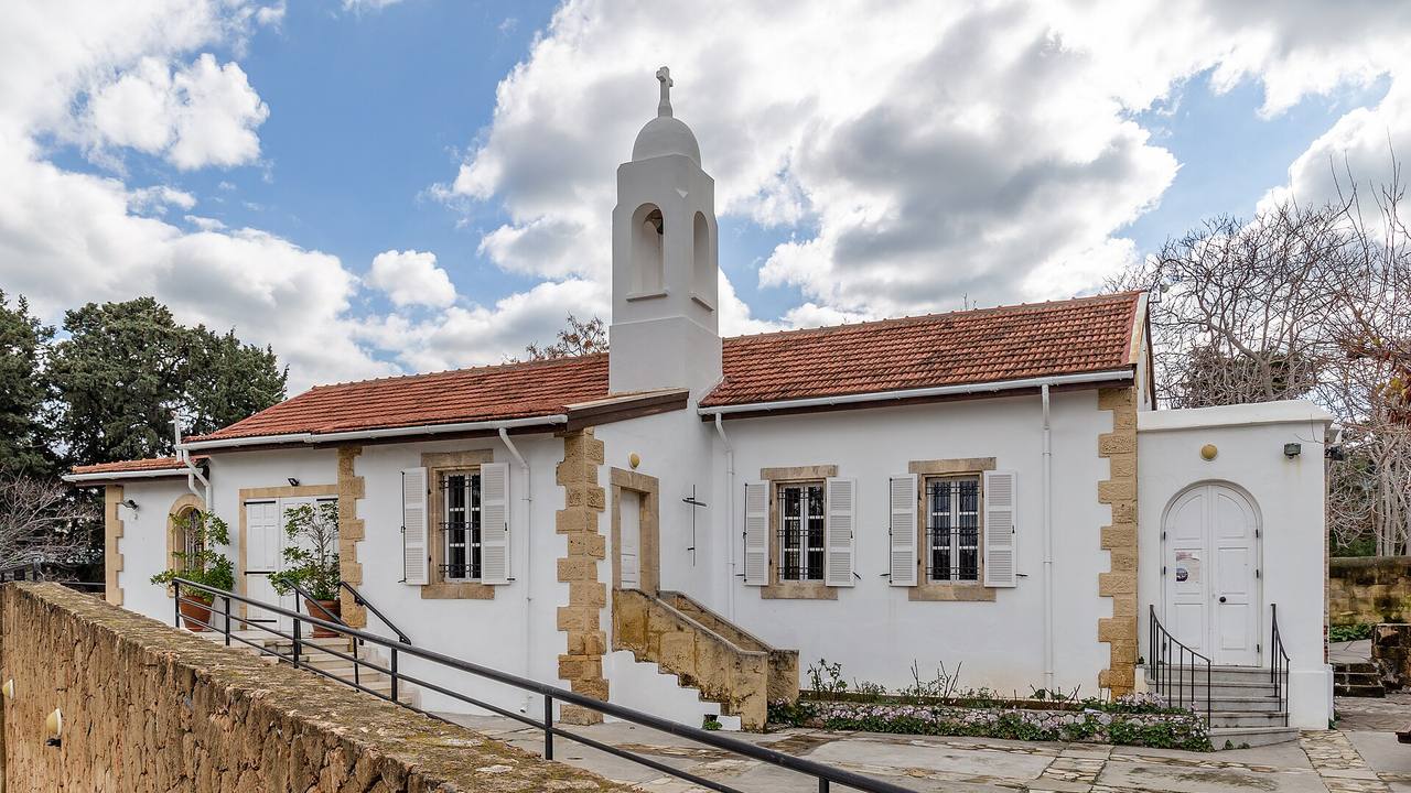
Michal Klajban · CC BY-SA 4.0 · Wikimedia Commons Church
St Andrew Kilisesi (St Andrew's Church)
Visit North Cyprus describes an Anglican church built in 1913, a few yards from the castle and harbour, with a font bowl found at Lambousa in 1949 and assigned to the 6th century.
Source: visitncy.com
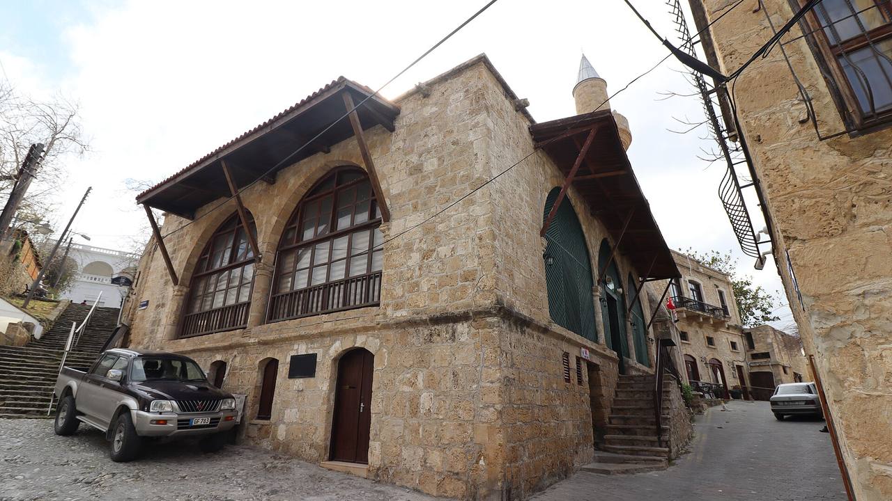
vlyalcin · CC BY-SA 4.0 · Wikimedia Commons Old town
Ağa Cafer Paşa Camii (Agha Cafer Pasha Mosque)
Visit North Cyprus places the mosque by a steep cobbled street running to the harbour, built in the 1580s in Ottoman style, with a single minaret and a fountain of 1841 to its south-east.
Source: visitncy.com
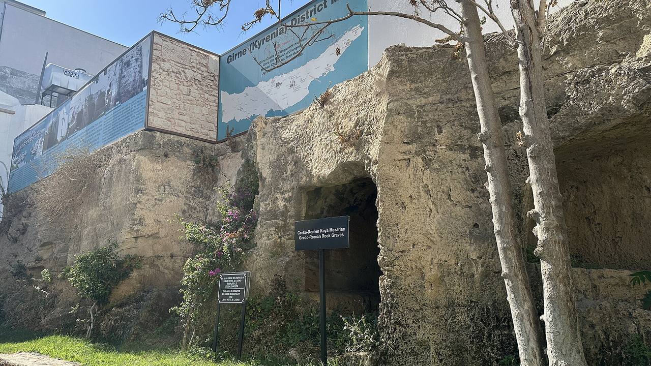
vlyalcin · CC BY 4.0 · Wikimedia Commons Old town
Greko-Romen Kaya Mezarları (Greco-Roman Rock Tombs)
Visit North Cyprus counts around 70 known tombs in Kyrenia, some cut into rock faces in the town centre and some under buildings, and notes that remains opposite the icon museum date to about 400 AD.
Source: visitncy.com
1 / 6

The castle, the shipwreck and the mountain forts
Girne Castle, the Girne Ancient Shipwreck and the three mountain forts are covered in Castles of North Cyprus, and the harbour-side family stops in family days out. One further detail comes from the Department of Antiquities and Museums: its castle page records the tomb of the Ottoman admiral Cezayirli Sadık Paşa in the entrance corridor of the Lusignan castle. The same page lists the shipwreck display, dated to about 300 BC, among the museum sections inside.
On the range behind the town, Wikipedia says the Kyrenia Mountains run along the northern coast, that Pentadaktylos (Beşparmak) is another name for them, and gives Mount Selvili as 1,024 m. Visit North Cyprus describes the range as a barrier between the Mesarya plain and the northern coast and a source of water for towns and villages, and lists a Besparmak Mountain Trail of 18 stages over 260 km. Wikivoyage advises staying on the lane to Saint Hilarion because the surrounding area is military.
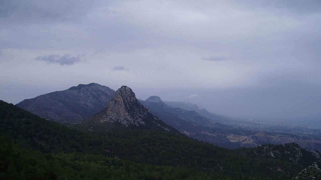
Atak at English Wikipedia · Public domain · Wikimedia Commons Mountain
Beşparmak Dağları (Kyrenia Mountains)
Wikipedia gives Beşparmak and Pentadaktylos as other names for the Kyrenia Mountains, which run along the north coast, with Mount Selvili given as 1,024 m; castles stand on several peaks.
Source: en.wikipedia.org
1 / 2
Villages and coast within a short drive
Bellapais lies at the foot of the Beşparmak mountains, according to the Department of Antiquities and Museums, which dates the first abbey building to 1198-1205 and notes the name derives from the French "Abbaye de la Paix". See Bellapais. Wikipedia describes Lapta (Lapithos) as a town near the ancient site of Lambousa that was a centre for copper processing and earthenware in Roman times; see Lapta and the Lapta coastal walk.
Wikipedia says Alsancak (Karavas) had 6,597 inhabitants in 2011 and that the Cyprus Treasure, a hoard of silver, was found there in 1902 and 1917; see Alsancak. It describes Karmi (Karaman) as a village west of Kyrenia with 55 residents in 2011, Çatalköy (Agios Epiktitos) as a village 6 km east of Kyrenia, and Esentepe (Agios Amvrosios) as meaning "breezing hill". See Esentepe, the Kyrenia area guide and beaches and coast.
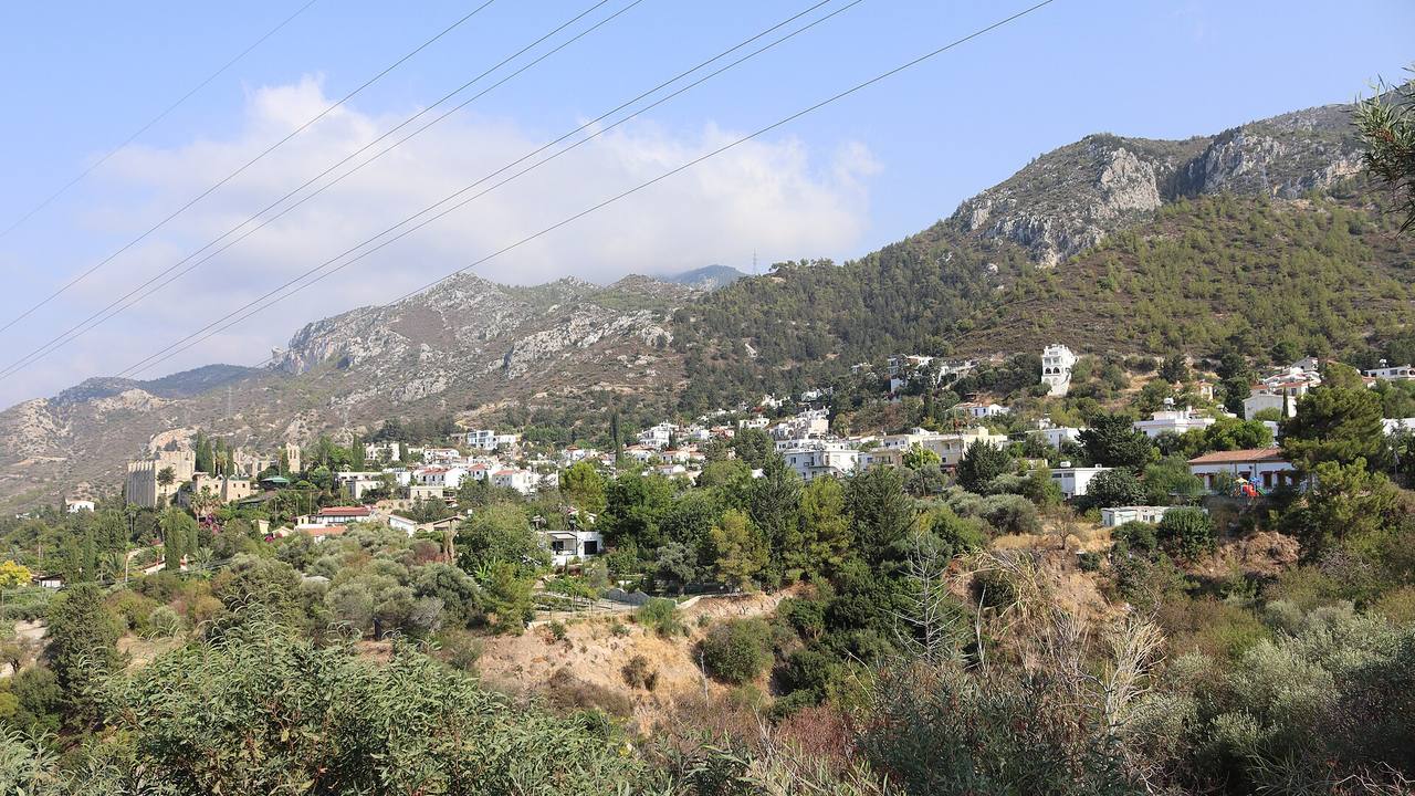
Karakalem · CC BY 4.0 · Wikimedia Commons Village
Bellapais (Bellapais Abbey village)
The Department of Antiquities and Museums places the abbey on a rock at the foot of the Beşparmak mountains and says the standing building was largely built under Hugh III, with cloister and refectory under Hugh IV.
Source: eemd.gov.ct.tr
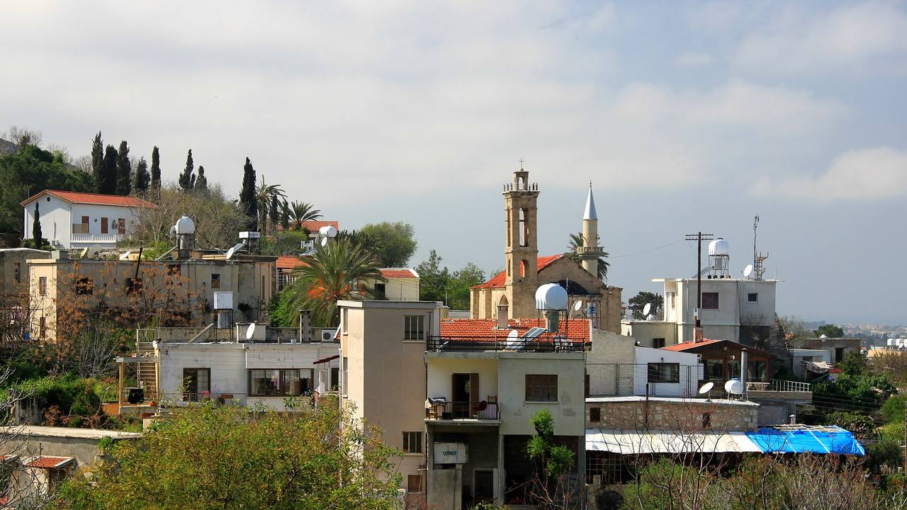
muffinn · CC BY 2.0 · Wikimedia Commons Village
Lapta (Lapithos)
Wikipedia describes a town near ancient Lambousa, noting findings dated as early as 3000 BC and a Roman-era role as a copper-processing and earthenware centre.
Source: en.wikipedia.org
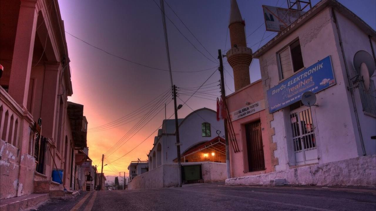
Paul Lakin · CC BY 3.0 · Wikimedia Commons Village
Çatalköy (Agios Epiktitos)
Wikipedia places the village 6 km east of Kyrenia and says its Greek name comes from an ascetic monk who fled the Saracens in the 9th century.
Source: en.wikipedia.org
1 / 6
Girne Municipality and the university town
The municipality's own administration page says Girne Belediyesi (Girne Municipality) was established in 1974, lists its mayors since then, and names Murat Şenkul as mayor since the 2022 local elections. It gives the area as about 50 km², running from the Ozanköy boundary in the east to the Alsancak municipality boundary in the west, and names Karaoğlanoğlu, Edremit, Zeytinlik, Doğanköy, Ozanköy, Beylerbeyi and Karakum as areas within it besides the town centre.
The official site, girnebelediyesi.com, carries news, events, tenders and a culture centre page describing arts courses. Wikipedia says the city has five universities, among them Girne American University, and describes an annual culture and arts festival and the Bellapais music festivals. Population figures differ between Wikipedia and the municipality's older census text, so none is given here. For sea, seasons and climate see weather and seasons.
1 / 2
Getting around, as sources state
Wikivoyage, a volunteer-written guide, says buses in Kyrenia resemble Turkish dolmuş minibuses that leave when full rather than on a fixed timetable, and that the bus station is a drop-off and pick-up point about 200 m south of the castle. It adds that minibuses along the coastal resort strip do not reach outlying sights such as Saint Hilarion, and that public transport from Ercan airport is limited. Check current arrangements locally before you travel.
For sea arrivals, Wikipedia says the Kyrenia Touristic Port opened in 1987 and receives ferry passengers from Turkey, while Wikivoyage places the ferry terminal about 1 km east of the historic harbour and castle. Wikipedia reports that a restoration of the old harbour began in December 2022; BRTK, the state broadcaster, quoted the tourism minister in 2023 saying it would be managed by a joint committee including Girne Municipality. We found no later report confirming completion.
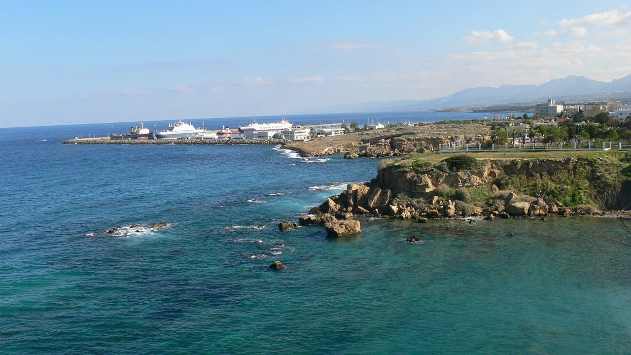
Xenophon · CC BY-SA 3.0 · Wikimedia Commons Harbour
Girne Turizm Limanı (Kyrenia Touristic Port)
Wikipedia says the port opened in 1987, handles commercial activity and serves as an entry point for ferry travellers between Turkey and Northern Cyprus; Wikivoyage places the terminal about 1 km east of the old harbour.
Source: en.wikipedia.org
1 / 1
Practical notes
- Visit North Cyprus does not name its owner on the pages we read; facts attributed to it are labelled as such, and the Department of Antiquities and Museums and Girne Municipality pages are official.
- Wikipedia and Wikivoyage are secondary and volunteer-written; they are attributed inline and used mainly for context, distances and the getting-around statements.
- The old harbour restoration is reported for 2022 and 2023 only; we found no report of completion or of the current management arrangement.
- Opening hours, fees and current access to museums and churches are not printed; the icon museum is reported closed for rebuilding by one source and described as a museum by another.
Frequently asked questions
What are the places to see in Girne?
Sources describe Girne Castle and the old harbour, the Harup Ambarı museum, the Archangelos Michael icon museum, the Ağa Cafer Paşa Mosque and rock tombs in town, plus Bellapais Abbey, Saint Hilarion and other villages nearby. Our guides link each one; check access locally.
Where is Kyrenia?
Wikipedia describes Kyrenia (Girne) as a city on the northern coast of Cyprus, noted for its harbour and castle and under the control of Northern Cyprus. Behind it rise the Kyrenia (Beşparmak) Mountains, which run along the north coast.
What is Kyrenia Old Harbour?
Visit North Cyprus describes a horseshoe-shaped harbour where former carob warehouses or Venetian dwellings now hold restaurants and shops, with pleasure craft and cruise boats moored where trading vessels once lay. Wikipedia reports a restoration that began in December 2022.
Is Kyrenia Castle in the harbour?
It stands beside it. The Department of Antiquities and Museums places the castle in the north-east of Girne, dominating the harbour, and Wikipedia puts it at the east end of the old harbour. Our castles guide covers its history.
What is Girne Municipality?
Girne Belediyesi is the local authority. Its own page says it was established in 1974, covers about 50 km² including Ozanköy, Doğanköy and Karaoğlanoğlu, and names Murat Şenkul as mayor since the 2022 local elections. Its site is girnebelediyesi.com.
Which mountains are behind Girne?
The Kyrenia Mountains, also called Pentadaktylos or Beşparmak. Wikipedia says they run along the northern coast and gives Mount Selvili as 1,024 m. Saint Hilarion, Buffavento and Kantara castles stand on the range.
Sources
- Department of Antiquities and Museums: Girne Castle
- Department of Antiquities and Museums: Bellapais Abbey
- Department of Antiquities and Museums: Harup Ambarı and Cyprus House Museum
- Department of Antiquities and Museums: Buffavento Castle
- Girne Municipality: municipal administration
- Girne Municipality: mayor
- Girne Municipality: culture centre
- Girne Municipality: home page
- Visit North Cyprus: Kyrenia Harbour
- Visit North Cyprus: Round Tower
- Visit North Cyprus: Chain Tower
- Visit North Cyprus: Archangelos Michael Church
- Visit North Cyprus: Chrysopolitissa Church
- Visit North Cyprus: Saint Andrew's Church
- Visit North Cyprus: Agha Cafer Pasha Mosque
- Visit North Cyprus: Greco-Roman Rock Tombs
- Visit North Cyprus: Carob Trees
- Visit North Cyprus: Boat Tours
- Visit North Cyprus: Besparmak Mountains
- Visit North Cyprus: Besparmak Mountain Trail
- Wikipedia: Kyrenia
- Wikipedia: Kyrenia Mountains (Pentadaktylos)
- Wikipedia: Lapithos
- Wikipedia: Karavas
- Wikipedia: Karmi
- Wikipedia: Agios Epiktitos
- Wikipedia: Agios Amvrosios (Kyrenia)
- Wikivoyage: Kyrenia
- BRTK: Minister inspects restoration work at old Girne port
- Severis Foundation (CVAR): Carob stores in Kyrenia harbour
Questions about North Cyprus?
Write to NORTHEA for a private conversation about areas, hotels or property.